


⏱️ 7 min read
The United States is rich with symbols that represent its values, history, and identity. From the majestic bald eagle to the iconic Statue of Liberty, these emblems tell the story of a nation. While many Americans are familiar with these symbols, there are fascinating details and surprising stories behind them that often go unnoticed. Exploring these lesser-known facts reveals a deeper appreciation for the symbols that define the country.
Surprising Stories Behind America's Most Cherished Emblems
1. The Bald Eagle Was Almost Replaced by the Turkey
Benjamin Franklin famously criticized the choice of the bald eagle as the national bird, calling it a bird of "bad moral character" because it steals food from other birds. He advocated for the wild turkey instead, which he considered more respectable and a true native of America. Despite his objections, the bald eagle was officially adopted in 1782.
2. The Liberty Bell's Famous Crack Remains a Mystery
The exact origin of the Liberty Bell's iconic crack is still debated by historians. While it's known that the bell cracked beyond repair in the 1840s, some records suggest it may have been damaged as early as its first test ring. The bell weighs approximately 2,080 pounds and is made of copper and tin.
3. Uncle Sam Was Based on a Real Person
The beloved Uncle Sam character was inspired by Samuel Wilson, a meat packer from Troy, New York, who supplied barrels of beef to the United States Army during the War of 1812. Soldiers began referring to the supplies stamped "U.S." as coming from "Uncle Sam," and the nickname stuck as a personification of the federal government.
4. The Star-Spangled Banner Survived Multiple Threats
The original flag that inspired the national anthem has undergone extensive preservation efforts at the Smithsonian. Measuring 30 by 34 feet today, it was originally even larger at 30 by 42 feet. Over the years, pieces were cut from the flag as patriotic souvenirs, a practice that was common in the 19th century before preservation became a priority.
5. The Great Seal Features an Unfinished Pyramid for a Reason
The reverse side of the Great Seal depicts an unfinished pyramid with 13 steps, representing the original colonies and symbolizing that the nation's work is never complete. The eye above the pyramid, known as the "Eye of Providence," represents divine guidance and has been a subject of numerous conspiracy theories.
6. Lady Liberty's Copper Skin Changes Color Over Time
The Statue of Liberty wasn't always the green color we see today. When first assembled in 1886, the statue was a shiny copper brown. The distinctive green patina developed over approximately 25 years due to oxidation, creating a protective layer that actually helps preserve the underlying copper structure.
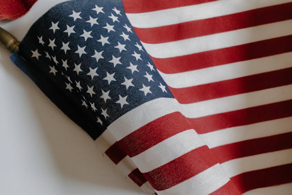
7. The American Flag Has Changed 27 Times
Since its adoption in 1777, the official design of the American flag has been modified 27 times to accommodate new states joining the Union. The current 50-star design has been in use since July 4, 1960, making it the longest-used version in U.S. history.
8. The National Motto Wasn't Always "In God We Trust"
Many people don't realize that the original unofficial motto of the United States was "E Pluribus Unum" (Out of Many, One). "In God We Trust" wasn't adopted as the official national motto until 1956, during the Cold War era, as a way to distinguish the United States from atheistic communist nations.
9. The Washington Monument Is Two Different Colors
Careful observers notice that the Washington Monument appears to be built with two slightly different shades of stone. Construction halted for 23 years due to lack of funds and the Civil War, and when work resumed, the builders couldn't find marble from the same quarry, resulting in the visible color difference about 150 feet up.
10. The Bald Eagle Population Nearly Went Extinct
By the 1960s, there were fewer than 500 nesting pairs of bald eagles in the lower 48 states, primarily due to DDT poisoning and hunting. Thanks to the Endangered Species Act and conservation efforts, the population has rebounded to over 70,000 birds, and the species was removed from the endangered list in 2007.
11. Betsy Ross May Not Have Sewn the First Flag
While the story of Betsy Ross creating the first American flag is widely taught, historians debate its authenticity. The tale came from her grandson nearly 100 years after the fact, and no contemporary documentation exists to confirm it. However, Ross was indeed a flagmaker during the Revolutionary period.
12. The Statue of Liberty Was Originally Intended for Egypt
French sculptor Frédéric Auguste Bartholdi initially designed a similar statue to stand at the entrance of the Suez Canal in Egypt. When Egypt rejected the proposal as too expensive, Bartholdi modified his design and presented it to the United States as a gift celebrating American independence and friendship between the two nations.
13. The National Anthem Is Notoriously Difficult to Sing
The Star-Spangled Banner spans an octave and a half in range, making it one of the most challenging national anthems to perform. The difficulty arises because Francis Scott Key wrote it as a poem, later set to the tune of a popular British drinking song called "To Anacreon in Heaven."
14. There's a Flag Flying Over the Capitol at All Times
The U.S. Capitol Architect ensures that an American flag flies over the building 24 hours a day, 365 days a year. Citizens can even purchase flags that have been flown over the Capitol through their congressional representatives, making for a unique patriotic keepsake.
15. The Liberty Bell Hasn't Rung Since 1846
The last time the Liberty Bell was rung was on George Washington's birthday in 1846. After the crack worsened beyond repair, it has been tapped on special occasions but never fully rung. The bell was originally cast in London and had to be recast twice due to cracking shortly after arrival in Philadelphia.
16. The National Bird Appears on Multiple Symbols
The bald eagle features prominently on numerous American symbols beyond the Great Seal, including presidential seals, military insignia, currency, and official government documents. Each depiction follows specific guidelines regarding the eagle's appearance, positioning, and accompanying elements.
17. The Pledge of Allegiance Wasn't Written by a Founding Father
The Pledge of Allegiance was written in 1892 by Francis Bellamy, a Baptist minister and Christian socialist, for a magazine's celebration of the 400th anniversary of Columbus's arrival in the Americas. The phrase "under God" wasn't added until 1954, during the Cold War.
18. American Gothic Is a Protected Symbol
While not an official government symbol, Grant Wood's 1930 painting "American Gothic" has become an iconic representation of American culture. The painting depicts a farmer and his daughter and has been parodied countless times, becoming one of the most recognizable images associated with American identity.
19. The National Mammal Was Only Designated in 2016
The American bison was officially designated as the national mammal through the National Bison Legacy Act, signed on May 9, 2016. This makes it a relatively recent addition to America's official symbols, chosen for its historical significance and role in Native American culture and the country's westward expansion.
20. The Rose Became the National Flower After Much Debate
In 1986, after years of discussion and competing proposals for various flowers, President Ronald Reagan signed legislation making the rose the official national floral emblem. The rose was chosen for its universal recognition and cultivation throughout the United States, though some argued for more uniquely American flowers like the marigold or dogwood.
The Enduring Significance of National Symbols
These twenty fascinating facts demonstrate that American national symbols carry far more depth and history than commonly known. From Benjamin Franklin's preference for turkeys to the Egyptian origins of Lady Liberty's design, each symbol has evolved through unique circumstances and human stories. Understanding these details enriches our appreciation of how these emblems came to represent American values and identity. Whether through the resilience of the bald eagle population, the mysterious crack in the Liberty Bell, or the gradual color change of the Statue of Liberty, these symbols continue to inspire and unite Americans while reminding us of the nation's complex and fascinating history.