








How Long Does Light Take To Travel From Sun To Earth?

1 / 10 Questions
0 Points

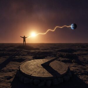
How Long Does Light Take To Travel From Sun To Earth?

8 minutes

8 hours

8 days

8 seconds

Points won
0
Correct score
0%

More Questions

More Articles

Hidden Geography Trivia: Secrets of the Sahara and More

Hidden Geography Trivia: Secrets of the Sahara and More

⏱️ 4 min read

Hidden Geography Trivia: Secrets of the Sahara and More

The world's geography holds countless fascinating secrets and lesser-known facts that continue to amaze both researchers and enthusiasts. From the mysterious landscapes of the Sahara Desert to peculiar geographical phenomena around the globe, this article explores some of the most intriguing geographical trivia that often goes unnoticed.

The Sahara's Hidden Secrets

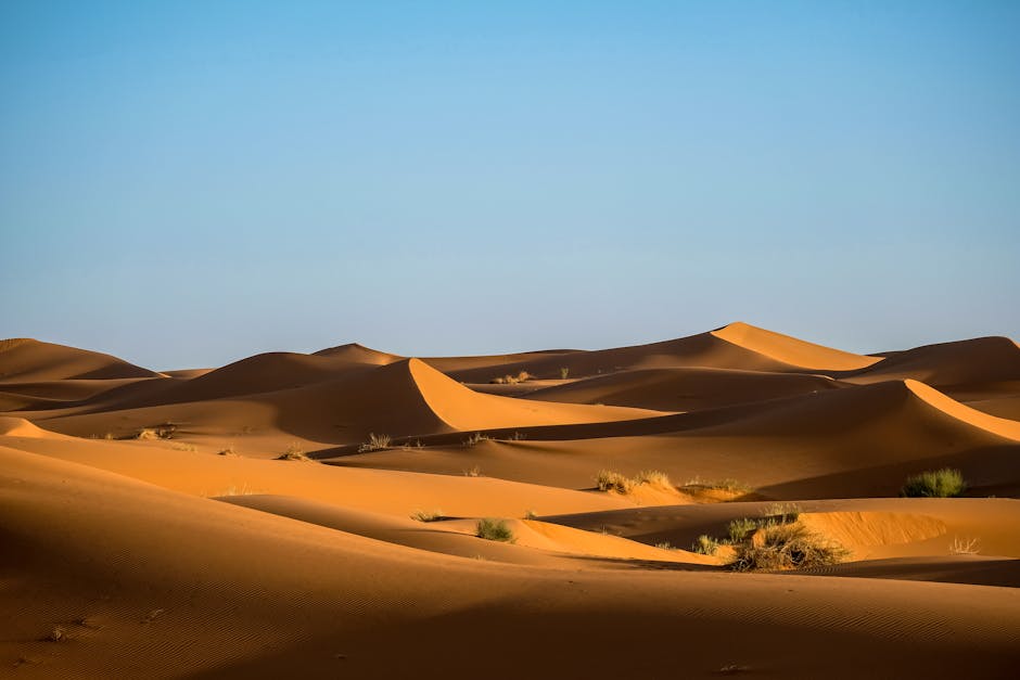
The Sahara Desert, Earth's largest hot desert, harbors numerous geographical mysteries that continue to fascinate scientists. Contrary to popular belief, the Sahara wasn't always a desert. Archaeological evidence suggests that approximately 10,000 years ago, the region was a lush savanna teeming with wildlife and human settlements.

One of the most remarkable features of the Sahara is the Richat Structure, also known as the "Eye of the Sahara." Located in Mauritania, this circular geological formation spans approximately 40 kilometers in diameter. Initially thought to be an impact crater, researchers now believe it resulted from a deeply eroded geological dome formed by volcanic activity.

Underground Rivers and Lakes

Beneath the Sahara's surface lies the Nubian Sandstone Aquifer System, one of the world's largest fossil water aquifers. This vast underground water resource extends beneath four countries: Sudan, Chad, Libya, and Egypt. The aquifer contains water that has been trapped underground for millennia, dating back to the last ice age.

  • The aquifer system contains approximately 150,000 cubic kilometers of groundwater
  • Some of the water dates back more than 1 million years
  • The aquifer system covers approximately 2 million square kilometers

Hidden Geographical Phenomena Worldwide

Beyond the Sahara, numerous geographical features and phenomena remain relatively unknown to the general public. These hidden wonders demonstrate Earth's incredible diversity and complexity.

The Great Blue Hole

Located off the coast of Belize, the Great Blue Hole is a massive underwater sinkhole that extends approximately 124 meters deep. Formed during several episodes of quaternary glaciation, this remarkable geological feature offers insights into past sea level changes and climate patterns.

The Dead Heart of Australia

Lake Eyre, located in South Australia, is the lowest point on the Australian mainland at 15 meters below sea level. This salt lake remains dry most of the time but occasionally fills with water, creating a temporary oasis in the desert. When filled, it becomes Australia's largest lake and transforms the surrounding ecosystem.

Geographical Anomalies

Several locations around the world present unique geographical anomalies that challenge our understanding of natural phenomena:

  • The Magnetic Hill in Moncton, New Brunswick, appears to pull vehicles uphill due to an optical illusion created by the surrounding landscape
  • The Coriolis effect, while real, is often misunderstood - it does not affect the direction of water in household drains
  • Point Nemo in the Pacific Ocean is the most remote location from land on Earth, situated approximately 2,688 kilometers from the nearest landmass

Climate and Geographical Interactions

The interaction between geography and climate creates unique phenomena that continue to surprise researchers. The discovery of tropical species fossils in polar regions provides evidence of dramatic climate changes throughout Earth's history. These findings help scientists understand past climate patterns and predict future changes.

Lesser-Known Geographical Records

While Mount Everest is widely known as Earth's highest peak above sea level, other geographical extremes receive less attention:

  • Mauna Kea in Hawaii is technically the world's tallest mountain when measured from its base on the ocean floor to its peak
  • The Challenger Deep in the Mariana Trench remains the deepest known point on Earth at approximately 11,034 meters below sea level
  • The Dead Sea, at 430.5 meters below sea level, is Earth's lowest land-based elevation

Geographical Time Capsules

Certain geographical features serve as natural time capsules, preserving evidence of Earth's past. Permafrost regions in Siberia and North America have preserved ancient plant and animal specimens for thousands of years. These frozen archives provide valuable information about past ecosystems and climate conditions.

The Impact of Human Activity

Human activities continue to reshape geography in unexpected ways. The construction of massive dams has altered Earth's rotation speed, albeit by a minimal amount. The weight of water in reservoirs has caused measurable changes in the planet's moment of inertia.

Future Geographical Changes

Ongoing geological processes ensure that Earth's geography continues to evolve. Tectonic plate movements, erosion, and climate change gradually reshape landscapes. Scientists predict significant changes in coastlines, river courses, and mountain ranges over the coming centuries and millennia.

Understanding these hidden geographical features and phenomena helps develop a deeper appreciation for Earth's complexity and dynamic nature. As technology advances, researchers continue to uncover new secrets about our planet's geography, demonstrating that there is always more to learn about the world around us.
Top 10 Secrets of Mount Rushmore You Didn’t Know

Top 10 Secrets of Mount Rushmore You Didn’t Know

⏱️ 7 min read

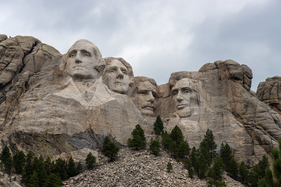
Mount Rushmore stands as one of America's most iconic landmarks, with the massive faces of four presidents carved into the granite cliffs of South Dakota's Black Hills. While millions visit this monument each year, few are aware of the fascinating secrets, hidden details, and untold stories behind its creation. Beyond the striking visage visible from the viewing platform lies a rich history of ambition, compromise, and extraordinary craftsmanship that transformed Gutzon Borglum's vision into reality.

Hidden Stories Behind America's Granite Monument

1. The Secret Chamber Behind Lincoln's Head

Few visitors realize that behind Abraham Lincoln's carved face lies a hidden chamber known as the Hall of Records. Sculptor Gutzon Borglum envisioned this 70-foot tunnel carved into the mountain as a vault to preserve American history for future civilizations. The chamber was intended to house important documents including the Constitution, the Declaration of Independence, and the Bill of Rights. While the project was never completed during Borglum's lifetime, in 1998, a repository of records was finally placed in the unfinished hall, sealed behind a 1,200-pound granite capstone. The chamber contains sixteen porcelain panels with text describing the monument's history and the reasons for selecting each president.

2. The Original Design Featured Full Bodies

Borglum's initial ambitious design called for the presidents to be carved from head to waist, not just as the colossal faces we see today. The original plans included carving the figures down to their waistlines, showing more of each president's form and stature. However, due to insufficient funding, unstable rock conditions, and the onset of World War II, the project was scaled back significantly. The monument was declared complete in 1941, following Borglum's death, even though it represented only about 20% of his original vision. Budget constraints limited the total cost to just under one million dollars, a fraction of what the full design would have required.

3. Thomas Jefferson Was Moved to the Other Side

Thomas Jefferson's placement on Mount Rushmore wasn't part of the original plan's positioning. Initially, Jefferson was supposed to be carved on George Washington's right side, where Theodore Roosevelt currently stands. Workers spent eighteen months carving Jefferson in that location before discovering that the granite was unsuitable and too fragile to support the massive sculpture. After this costly mistake, the entire face had to be blasted off and restarted on Washington's left side. The dynamited Jefferson face left a visible scar on the mountain that can still be detected by careful observers, though it has weathered considerably over the decades.

4. No Workers Died During Construction

Despite the dangerous nature of carving a mountain with dynamite and working hundreds of feet above the ground, not a single worker died during Mount Rushmore's fourteen years of construction. This remarkable safety record is extraordinary considering that nearly 400 workers participated in the project, dangling from cables while operating jackhammers and handling explosives. The workers, many of whom were miners recruited from the surrounding area during the Great Depression, removed approximately 450,000 tons of rock. They were paid eight dollars per day, which was considered excellent wages during the 1930s economic crisis. The project's commitment to safety protocols and Borglum's insistence on proper equipment contributed to this unprecedented achievement.

5. Ninety Percent Was Carved Using Dynamite

Contrary to popular belief that the monument was meticulously hand-carved, approximately 90% of Mount Rushmore was actually carved using carefully controlled dynamite blasts. Borglum developed an innovative technique called "honeycombing," where workers drilled holes in a specific pattern and depth, then placed small dynamite charges to remove rock in precise increments. This method allowed sculptors to blast away granite to within inches of the final surface. Only the final three to six inches were finished using hand tools, bumpers, and pneumatic hammers. This revolutionary technique made the massive project feasible within the available timeframe and budget while maintaining the artistic integrity Borglum demanded.

6. The Mountain Was Originally Named for a New York Lawyer

Before becoming synonymous with presidential grandeur, the mountain was named after Charles E. Rushmore, a New York attorney who had no connection to the Black Hills region. During an expedition to the area in 1885 to inspect mining claims, Rushmore asked his guide about the mountain's name. When told it had no official name, the guide jokingly replied that from then on it would be known as Rushmore. The name stuck, and it was officially recognized by the U.S. Board on Geographic Names. Ironically, Charles Rushmore later became one of the monument's financial supporters, donating $5,000 to the project—making him the largest individual contributor at the time.

7. The Faces Are Designed to Last 7.2 Million Years

Geologists have calculated that Mount Rushmore's granite faces erode at a rate of approximately one inch every 10,000 years, meaning the monument could remain recognizable for over seven million years under current environmental conditions. The Black Hills granite was specifically chosen for its fine grain and exceptional durability. This erosion rate is remarkably slow compared to most other materials and monuments worldwide. The lack of significant weathering since completion in 1941 has validated these predictions. However, modern concerns about climate change, acid rain, and increased freeze-thaw cycles may accelerate deterioration, prompting ongoing preservation efforts and regular monitoring by the National Park Service.

8. Each President Was Chosen for Specific Reasons

The selection of Washington, Jefferson, Theodore Roosevelt, and Lincoln wasn't arbitrary but represented specific themes in American history. George Washington symbolizes the nation's founding and independence. Thomas Jefferson represents expansion and the Louisiana Purchase. Abraham Lincoln embodies preservation of the nation and equality. Theodore Roosevelt was chosen to represent industrial development and conservation efforts. Interestingly, Roosevelt was the only president still alive during the early planning stages, though he died before any carving began. The choices proved controversial, particularly Roosevelt's inclusion over other historically significant presidents, but Borglum defended his selections as representing the nation's first 150 years of democracy, growth, preservation, and development.

9. The Lakota Sioux Consider the Site Sacred and Stolen

Mount Rushmore occupies land within the Black Hills, which holds profound spiritual significance for the Lakota Sioux people, who call it "Six Grandfathers." The region was granted to the tribe through the 1868 Treaty of Fort Laramie, but the U.S. government seized the land following the discovery of gold in 1874. The Supreme Court ruled in 1980 that the land was taken illegally and awarded financial compensation, which the Lakota have refused to accept, demanding the land's return instead. The unclaimed compensation, held in trust, has grown to over one billion dollars with interest. This ongoing controversy adds a complex layer to Mount Rushmore's legacy, highlighting the tension between American symbolism and indigenous sovereignty that remains unresolved today.

10. A Planned Fifth Face Was Never Realized

Plans existed for a fifth face on Mount Rushmore, though historians debate who it might have been. Some documentation suggests Susan B. Anthony was seriously considered, which would have made the monument more inclusive by representing women's suffrage and rights. Other accounts indicate that additional space left by Borglum was intentionally kept available for future generations to add presidents as they deemed appropriate. However, the combination of Borglum's death, World War II, funding exhaustion, and the technical challenges of the remaining rock made any additions impossible. The National Park Service has since determined that no further carving will occur, preserving the monument as Borglum and his son Lincoln left it in 1941.

Conclusion

Mount Rushmore's secrets reveal a monument far more complex than the simple patriotic symbol many perceive. From the hidden Hall of Records to the controversial history of the land itself, these lesser-known facts demonstrate the ambition, ingenuity, and compromise involved in creating this American icon. Understanding the technical innovations like honeycomb blasting, the remarkable safety record, and the unfulfilled grand visions provides deeper appreciation for both the achievement and its limitations. The ongoing dialogue about its location on sacred indigenous land reminds visitors that even our most celebrated landmarks exist within complicated historical contexts that deserve acknowledgment and respect.